As the well-known maxim says, everybody dies twice. First when the heart stops, and again when one is forgotten, when one’s personality, work, and memory have faded away or ceased to be present in the world. The second is the real act of dying.
Count Pál Teleki’s colleague, the geography professor Ferenc Fedor described him by saying that he did not believe that Pál Telekiwould ever succumb to this death of the spirit, that a great Hungarian of his stature and depth of character could ever fall into oblivion. Yet Teleki’s work in his principal field of specialization, geography, has remained in relative obscurity since his passing, despite the enduring merit of his scientific endeavours.
Teleki the famous politician continues to upstage the humble scientist who works quietly but all the more successfully in the background. This makes it especially important to recall a few of his internationally recognized achievements in cartography and geography.
Pál’s interest in geography was nourished by the legacy of Count Sámuel Teleki (1845– 1916), the celebrated explorer who erased the last remaining blank spot from the map of Africa. Sámuel Teleki is immortalized by a 646-metre tall active volcano in East Africa, just one of the natural features around Mount Kenya named after him, along with a glacial valley, a lake, and a shelter-house. It was his expedition between 1886 and 1887 which discovered lakes Rudolf and Stephanie. The endeavour’s contributions to our knowledge of the area in terms of geography, ethnography, botany, and zoology attained world fame owing to the travelogues written by the Austrian Ludwig von Höhnel, Sámuel Teleki’s companion, published in German, English, and Hungarian. All in all, Sámuel Teleki’s expedition continues to be regarded as the single greatest achievement of African exploration ever attained by a Hungarian.1
Career orientation
Pál Teleki was a frequent house guest at his uncle’s mansion in Sáromberke, Transylvania (today in Romania) where the interior easily evoked the exotic, remote world of Africa, as it was richly decorated with an ethnographic collection of lances, masks, drums, shields, and cookware. The immense library and the colourful stories related to Pál by his famous explorer uncle incited the curiosity of the susceptible teenager. Open-mouthed, he would listen to Count Sámuel embellish his adventures of meeting the Maasai, the Turkana, the Samburu, or recount the thrills of a rhino hunt.
It was also here, in Sáromberke, that Pál Teleki first perused the English, German, and French geographical papers and journals which carried reports on various expeditions of the day. Having graduated from the Piarist Grammar School, in 1897 he began to study law on the recommendation of his parents. In his junior year, his growing interest in the remote corners of the world led him to attend the lectures of Lajos Lóczy, the world-renowned orientalist, and he soon committed himself to the discipline of geography. He had not yet turned twenty when he gave an enthusiastically received talk at the Hungarian Geographical Society on 15 December 1898, entitled Periods of Expeditions to Asia. (The lecture was published the following year by the Geographical Bulletin [Földrajzi Közlemények].)2
In 1901 and 1902, Teleki attended courses at the Academy of Agriculture in the city of Mosonmagyaróvár. A year later, he submitted his doctoral dissertation under the title Reflections on the Origins of the State. He was influenced heavily by Alexander von Humboldt, the preeminent figure in geographical synthesis, whose work he continued to cite regularly in his lectures later in life. Lóczy and another professor, Jenő Cholnoky, recognized Teleki’s exceptional talent, skills, and industrious working habits. His erudition and extensive reading were evidenced by the in-depth reviews of books in German, English, and French, which he published in the Geographical Bulletin.
Early on, he developed a keen interest in old maps, and was particularly fascinated with the chronology of discoveries in Asia. He decided to make a name for himself in domestic and international science by researching, collecting, and showcasing the cartographic relics of expeditions to East Asia. His Atlas for the Cartographic History of the Japanese Isles, published in 1909 after years of research and recognized by the French Jomard Prize, was met with great international acclaim. Teleki had made self-funded trips to libraries in Vienna, Florence, Paris, and The Hague to study maps for his project. Just as importantly, he drew heavily on a forgotten ship’s log belonging to Commander M. H. Quast and Captain A. J. Tasman. In 1909, the international geophysical congress in Geneva elected Teleki member of a committee for the study of old maps. The 1966 facsimile edition of his Atlas in Japan testifies to the enduring value of his work, as do other atlases he co-authored with Manó and Károly Kogutowicz. These publications earned wide recognition for the young scientist.3
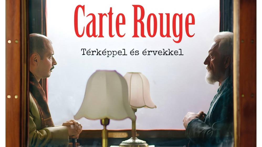
Teleki’s most oft-cited work of cartography, however, is the so-called Carte Rouge, or Red Map, a comprehensive representation of the ethnic composition of the Carpathian Basin. This map is based on the idea of assuming an even population density and then colouring the map with a code, with each square millimetre corresponding to a set number of ethnic population. Árpád Papp-Váry assessed the map as follows:
‘[T]he editing principle that worked best was to equate 1 mm2 with 100 inhabitants. With this method of representation, cities with a larger population occupy a map area greater than their relative surface area in geographical terms, while smaller districts are often left blank, without a colour code. Grouping these blank districts with the sparsely populated mountainous areas can yield a survey map that provides a good illustration of the distribution of ethnicities. […] The map shows Hungarians in red, Germans in orange, Slovaks in green, and Romanians in purple. The Red Map owes its name to the prominence of Hungarian-populated areas. It is a scientifically rigorous representation which reflects actual conditions in terms of the spatial distribution of ethnicities in the Carpathian Basin, in a professionally unassailable manner. It clearly gives the lie to the claims, increasingly popular in recent decades, that it was an ideologically tweaked enterprise intended to help defend the territorial integrity of Greater Hungary. Fearful of the truth and international influence of the map, Romania kept attacking it in various publications as late as in the mid-1930s.’4
The League of Nations recognized Teleki’s professionalism and objectivity in research in 1924 by inviting him to serve on the international expert committee tasked with making a proposal for the border between Turkey and Iraq.
The scientific pursuits of the Peace Office
Having been on the losing side in the First World War, every responsible Hungarian politician had to face the challenges of the impending peace talks
On behalf of the Hungarian party, Pál Teleki shouldered the lion’s share in preparing for the negotiations. Everyone had been aware of the victors’ ambitions to chop up the hitherto unified state authority in the Carpathian Basin. Teleki believed that the preservation of the Carpathian Basin as an undivided hydrographical unit could serve as a compelling argument of natural geography against splitting up the region politically. Specifically, he realized that artificially redrawing the borders of Hungary to accommodate the prevailing powers and interests of the day would literally inundate the country with insurmountable difficulties in regulating its rivers. Under the direct threat of floods, particularly of the River Tisza, which originates in the Carpathians, along with its tributaries, the rivers Körös, Szamos, and Maros, would put Hungary at the mercy of its neighbours, first and foremost Romania, in terms of water management. However, the decision-makers in Trianon chose not to seek the solution in comparing and contrasting scientific arguments. It was after they had prevailed that Teleki formulated his observations about ‘the Europe of winners’ and ‘the Europe of losers’.5
The pioneer of Hungarian economic geography
Pál Teleki was elected secretary general of the Hungarian Geographical Society in 1911, at a young age. He kept abreast of domestic publications in his field, writing regular reviews of professional books as they appeared in print. He maintained his characteristic polemic stance to the end of his life. He never bowed to authority, only to truth established by fact and argument. As a scientist, he always looked for correlations and would investigate geographical phenomena strictly in the context of causes and consequences.
One of his close students, László Kádár, former professor of the Kossuth Lajos University in Debrecen, addressing a narrow circle of students (including the author of this article) in his special seminar of palaeography and the history of science in 1978, noted that Teleki set great store by analytic research but never considered it a self-serving goal. Instead, he invariably used his findings as building blocks toward articulating a larger synthesis. He was deeply influenced by Lajos Lóczy, who had been regarded for some time as the doyen of investigative methods in natural geography and geology in Hungary. What Lóczy had first proposed in these fields was picked up and elaborated by Teleki in the disciplines of economics, politics, and human geography. Today, we would say that he was the forerunner of applied geography and human geography in Hungary.
To a significant extent, Teleki’s research methods were inspired by a study trip he made to the New World in 1912, at the invitation of the American Geographical Society, which was celebrating its 60th anniversary by hosting a conference and sponsoring transcontinental visits by the foremost geographers of the world, who gave presentations about their respective countries. Teleki was accompanied by his professor Jenő Cholnoky on this trip where they had a chance to gain on-site experience with American farm belts as defined by climate and soil properties.
As well as being deeply impressed by the natural beauty of the land, Teleki familiarized himself with the latest techniques of regional management and the organizational units of industrial production, making visits to production facilities, factories, and active mines. He saw how the typical American was always ready to change his residence and job as frequently as dictated by marketdemand. In the cities he found that the various towns or neighbourhoods had emerged along ethnic lines, and that the residents of Italian, Greek, and Chinese quarters hung on to the language, culture, and culinary heritage of their homelands. Gaining first-hand insight into the destiny of millions of immigrants in search of a better life proved to be a formative experience for Teleki. It was during this trip that his decision to become an economic geographer was made.6
He was then the first to give regular, scientifically inspired lectures on American economic geography at the Faculty of Economics in Budapest. After his first term as Prime Minister, his reputation in America earned him an invitation as a visiting lecturer at Williams College in Massachusetts. His lectures on Hungary were so successful that in 1932 Macmillan in New York decided to bring out the series in a single 312-page volume entitled The Evolution of Hungary and Its Place in European History. Teleki then published his Amerika gazdasági földrajza (American Economic Geography) in Budapest. András Rónai described these two works as veritable treasures of economic and political geography in their sheer inherent merit. Had Pál Teleki not written anything else, his name would still be mentioned among the great pioneers of Hungarian geographical literature.7
Nor can we forget another major work, A földrajzi gondolat története (The History of Geographical Thought), Teleki’s inaugural address at the Hungarian Academy of Sciences, published in print in 1917, in which the author demonstrates erudition in the history of science, biology, history, and philosophy, of a breadth and depth that very few of his contemporaries could rival. The demand to form bridges between various fields of science— what we would today call an interdisciplinary approach—remained a leitmotif throughout his work later in life.8
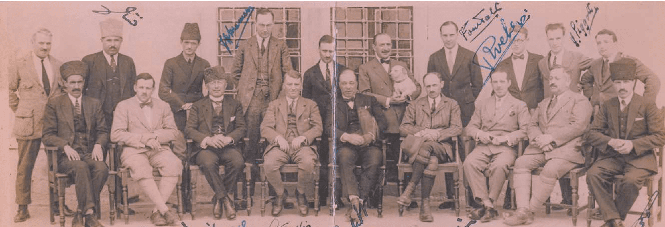
On the Mosul Committee
The citizen of a country vanquished in the First World War, Teleki was appointed to a momentous task in the League of Nations in 1924. Serving on a three-strong committee in 1924–1925, he played an important role in the demarcation of the border between Iraq and Turkey. Before making their final proposal, Teleki and the other two committee members, the Belgian colonel Albert Paulis and the Swedish diplomat Einar af Wirsén spent months on a field trip in the region. What was at stake was nothing less than jurisdiction over the entire Mosul Vilayet. The team was responsible for charting the conditions of the region in terms of nationalities, ethnic groups, demography, and agriculture, based on their travels in the provinces of petroleum-rich Iraq, then under British control, and on their research of the relevant professional literature. Pál Teleki owed his appointment to the methodology of his Carte Rouge, submitted in Paris in 1919, which had garnered him a solid international reputation. True enough, the border was subsequently drawn along the so-called Brussels Line proposed by parties close to British interests, but this did not diminish the peerless academic merits of the committee’s comprehensive report on the natural and economic conditions of the region, and on Kurdish society. The Mosul Report lucidly examined the conflicting Iraqi–British and Turkish interests, and outlined the possibility of a referendum, the solution preferred by Turkey to settle the fate of the Mosul Vilayet, and thus of its abundant natural resources, particularly crude oil.9
Teleki recognized Kurdish ethnic unity and did not want to separate this people with a border. Creating an autonomous Kurdish state was out of the question, though, for reasons which were certainly beyond Teleki’s control. The Mosul Committee thought it would be best to adopt a natural border acceptable to both parties, although with considerable allowance made for human factors, for instance by ensuring that the Yazidi and other ethnic groups remained within one unified territory.
Teleki insisted on the importance of recognizing specific features of natural geography, climate, lifestyle, ethnography, water supply, and land use. These factors were incorporated in the description of the disputed territory, adding a certain subtle complexity to the understanding of the positions adopted by Turkey, Iraq, and Britain.
Of particular note were the findings of the report concerning the allocation and management of waters. No stranger to the problems arising from splitting up an organic water system by redrawing borders (as it had happened in the Carpathian Basin), Pál Teleki was of the opinion that the catchment area of each river should legally belong to the country utilizing those waters for crop irrigation. He knew well that human intervention in the upper reaches of rivers (for instance dams, reservoirs, and other forms of water retention) could have a harmful impact on the water supply of low-lying areas, sometimes to the point of preventing irrigation altogether. As it transpired, the sharing of the resources of the Tigris–Euphrates river system would indeed go on to trigger several later conflicts.
Teleki delved into the lifestyle of nomad peoples and the geographical causes and consequences of mass migration, summarizing his findings in fine descriptions of natural features, transport conditions, and the economic activities performed by groups and peoples living in the region. He gained first-hand experience of the living conditions of Kurdish, Turkish, and Arab peoples, as well as various tribes, surveying their paths of migration, customs, and social arrangements.
The Mosul Report provides a realistic picture of the region by illuminating its complex conditions from the vantage point of history and geography. Describing in detail the ethnic groups of the Mosul Vilayet, along with their economic pursuits and the natural features of their land, Teleki emphasizes the imperative to protect minorities, and to safeguard the rights of the Kurds in particular, arguing that Kurdish should be the official language in schools and public administration. He also advocates autonomy for the Yazidi, freedom of religion, and free trade.10
The Mosul Report earned Teleki international renown, enabling him through the League of Nations to voice his views on ethnic minorities, and to use the opportunity to draw attention to the situation of Hungarian minorities that had found themselves on the other side of the new Hungarian border in the wake of the Trianon Peace Treaty.
The professor of political geography
Owing to his professional authority, Teleki continued to enjoy great influence in senior government circles after his first tenure as prime minister (1920–1921)
He exploited his extensive connections to create institutions where his colleagues could pursue research in work conditions at the highest standards of academic endeavour. The Institute of Sociography, the Institute for Land and Ethnic Research, and theInstitute of State Science recruited the finest scientists of the day. An expert staff working under Professor András Rónai at the Central Statistical Office monitored the geographical, demographic, and economic situation of Central European countries, amassing an extraordinary database that would later serve as scientific background for Hungary’s later claims for the re-annexation of its former territories. The First and Second Vienna Awards (in 1938 and 1940), which temporarily returned territory to Hungary from Czechoslovakia and Romania respectively, were realized without
Teleki always paid intense attention to issues of national minorities, using his minority maps to objectively illustrate, corroborate, and augment his geographical observations. His achievements in this field were so impressive that they were even recognized, however reluctantly, by Professor Somesann, a mouthpiece of Romanian propaganda. As professor of political geography, Teleki insisted on examining global issues in a geopolitical context—an approach unique among, and quite novel to, his contemporaries.11
The invasion of Abyssinia prompted him to deliver a brilliant university lecture, explaining why it was impossible for the Italian Protectorate to open a natural corridor from Libya to Abyssinia. He demonstrated the unviability of Italian colonial ambitions by analysing the natural resources of Sudan and the British colonial empire, which he knew well. His discussion of the political geography of the Cairo–Khartoum–Cape Town line and British rule in Africa, particularly in terms of the potential of conflicting interests to swell into an unmanageable global crisis, attested to a geographer peerlessly well-versed in the affairs of the continent.
Not only did he foresee the fiasco of Italian encroachment in Africa, but he predicted, with the same incisive insight, that the invasion of China by Japan—a country he much admired—would not ultimately succeed, and that its temporary successes would not change the inevitable outcome. He refuted opinions focusing on Japan’s initial military achievements by weighing the actual natural resources, energy sources, and reserves of manpower possessed by the two countries. He maintained this assessment of the situation later on as he surveyed the potential consequences of the conflict between the Axis and Allied powers. Rather than being blinded by Germany’s momentary military exploits, he preferred to view events with reference to underlying realities.
Teleki never cared much for authoritative declarations. He always sought to identify the background, constituent elements, and ultimate motivation behind ambition, analysing geographical phenomena, historical processes, and political developments. His exceptionally wide erudition would often embarrass his detractors. He was known to work fourteen to fifteen hours a day, poring over hundreds of pages of briefs, reports, articles in four languages, memorizing hundreds of names and economic figures at a time.
Even though he attracted the most public attention, and sometimes controversy, in his capacity as a politician, he never really felt at ease on the stage of public affairs. He did not actively seek position or appointment, but always met the challenge head-on whenever he was called on to fulfil his public duty. He was fatigued by party meetings, averse to bureaucratic intrigue, and often dismayed by the bickering in Parliament. Where he truly felt comfortable and in his element was in his university chair, among his fellow staff members and students, simply because he felt that academia was the ideal venue for him in which to expound his views. Just as importantly, he habitually recognized all of his debating partners as equal in rank, without regard to age, standing, or academic position.12
The organizer of Academia
Teleki always shouldered a heavy workload, and expected the same from those around him. He read vociferously and considered being up to date an indispensable part of academic life. His unrelenting openness and thirst for knowledge became an example for others to follow. True, the teaching load of university lecturers at the time was far more modest than it is today, leaving them more time to devote to publication and research.
His tirelessness was legendary at the Faculty of Economics of the Royal Hungarian University, where he founded the Oriental Institute, the successor to the Oriental Academy. His former colleague, Gyula Germanus once told me that Teleki would often stay in at his university office late into the night before he held a lecture, taking note of articles hot off the press in order to incorporate the latest findings into his talk the following day.
Teleki went out of his way to help his most gifted students continue their studies at the finest universities in the West. As President of the National Grant Council, he was instrumental in furthering the careers of qualified youths by securing their enrolment in graduate programmes at the foremost professional institutes in Berlin, Paris, Göttingen, Heidelberg, Zurich, and Munich. This was how the geomorphologist Béla Bulla secured the opportunity to study under Professor Büdel in Berlin, and how TiborMendöl went to Paris to familiarize himself with the achievements of the French school of settlement geography. Co-authored by Bulla and Mendöl, these two distinguished geographers, the volume A Kárpát-medence földrajza (Geography of the Carpathian Basin) is informed by an approach that has stood the test of time since its publication.
Teleki was a close friend of Jovan Cvijić, the mastermind behind a unique school of human geography and ethnography in Belgrade, and often quoted him as saying, ‘The soul of the land in the geographical sense is none other than man, who not only possesses houses, villages, cities, and cultivated fields, but has his own community and poetry as well’. It was with Teleki’s assistance that works describing the Cvijić method and various studies in the human geography of the Balkans were printed in Budapest in 1917, at a time when Hungary was officially at war with Serbia. The collected studies were published in a volume dedicated to the anthropogeography of the Serbs.
Pál Teleki regularly attended, often as invited lecturer, various international conferences, meetings, and congresses in the field of geography
Even among the professionals of his field, few recall the extensive and often quietly fruitful personal contacts he established and nurtured on these occasions. As pointed out to me by Professor Béla Gunda, the Herder Prize laureate ethnographer and former student of Teleki’s based in Debrecen, his mentor maintained good relations with his Soviet colleagues. Teleki knew and frequently cited the work of Obrushchev, and had high regard for Vavilov, another, tragically fated Russian geographer, who published research on the origin of crops as well as a monograph on the agriculture of Afghanistan, which Teleki consulted for the purposes of his own work.
Despite his global outlook, Teleki never glossed over local events with geographical implications, no matter how inconsequential they seemed in the wider context. For instance, he was dismayed when Romania issued a decree requiring authorities to use Hungarian place names in their Romanian version only in their press communications. In 1936, while he spent summer in Transylvania, he arranged a number of non-official meetings with senior Romanian politicians.
Teleki chose to remain tight-lipped about these private conferences, but we know that he received several visits from, and entered into lengthy discussions with, Iuliu Maniu, the Peasant Party politician, and Nicolai Titulescu, the former Minister of Foreign Affairs of Romania. As a result of these meetings, the Romanian authorities repealed the offensive decree almost instantly. This was just one episode attesting to Teleki’s talent for convincing his negotiating partners, a skill he continued to demonstrate throughout his career.
He regarded Eötvös College, where he served on the board of curators from 1920, as the foremost centre for organizing academic life. That time-honoured institution was instrumental in broadening the intellectual horizons of many less wealthy youths, with Teleki being personally in charge of procuring fellowships, grants for field trips at home and abroad, and financial assistance with publication.13
He was an altruistic advocate of the Boy Scouts, a movement of British origins, which he supported for decades and attended classes, hikes, and camps. He made a crucial contribution to the movement by arranging for the town of Gödöllő to host the Jamboree, the meeting of Boy Scouts from around the world, in 1933.
He believed that the Boy Scouts, with their affirmed democratic principles, love of the outdoors, and emphasis on community experience, could present a sufficiently weighty alternative to the youth organizations created by dictatorships to either side of Hungary, the Hitler Youth of Germany and the Komsomol of the Soviet Union. The movement recruited hundreds of thousands of Hungarian youths, rewarding them with lifelong memories of adventures and friendships.14
Always setting his sights on value, Teleki recognized no standard superior to quality and performance. When I met one of his students, Elemér Újpétery, who would later become a diplomat in Lisbon, he remarked that Teleki had a keen eye for recognizing outstanding talent during examinations and admission procedures. If this talent went hand in hand with industriousness and ambition, he would spare no effort to further the student’s career, even as he abhorred protectionism and its beneficiaries. He would peremptorily turn down anyone who attempted to pressure him to award a post or grant to a protégé without merit, particularly when this was done through the abuse of authority. He regarded protectionism as the cancer of officialdom, and in his field of science, he fought it tooth and nail, as best he could.
He was good friends with Sir Aurel Stein, the world-famous Hungarian–British orientalist specializing in Central Asia, who served the British administration. It was on Pál Teleki’s recommendation that Stein was appointed honorary member of the Kőrösi Csoma Sándor Society in 1926. In a letter to Stein, then serving in Srinagar, Kashmir, Teleki wrote the following:
‘This to respectfully inform you that you have been elected honorary member of the Kőrösi Csoma Sándor Society at the first general meeting of the same. The Society is engaged in the research of the Orient, particularly its aspects of interest to the Hungarian nation on account of its history and current situation. Your distinguished work in exploring the Orient has been followed with the utmost interest in Hungarian professional circles, and your results have been held in high regard and successfully utilized in their own scientific endeavours.’15
It is for a reason that the bronze busts of Pál Teleki—who met his fate in tragic circumstances in April 1941—and of the great explorer Aurel Stein—who died in Afghanistan in 1943—were erected in close proximity in the gardens of the Hungarian Geographical Museum in Érd, as if these two works of art were intended to pay tribute to a friendship that had spanned calamitous decades and distant continents. A fitting message for posterity, indeed.
Translated by Péter Balikó Lengyel
NOTES
1 János Kubassek, Zanzibártól a Stefánia-tóig – Teleki Sámuel nyomában (From Zanzibar to Lake Stephanie –In the Traces of Sámuel Teleki) (Bembo, 1989).
2 János Kubassek, ‘Teleki Pál, a magyar politikai földrajz atyja’ (Pál Teleki, the Father of Hungarian Political Geography),http://www.mtte.hu/sites/default/files/dokumentumok/versenyek/Teleki/2014_2015/2011_12_Teleki_Pal.pdf; Mária Kőrösi, Gróf Teleki Pál élete és munkássága (Life and Work of Count Pál Teleki) (Budapest: Magyar Természettudományi Társulat Földtudományi Szakosztálya, 2000), http://www.mtte.hu/sites/ default/files/Teleki_Pal_elete_es_munkassaga1.pdf.
3 Kubassek, ‘Teleki Pál, a magyar politikai földrajz atyja’; Kőrösi, Gróf Teleki Pál élete és munkássága.
4 Árpád Papp-Váry, ’Teleki Pál a kartográfus’ (Pál Teleki the Cartographer), in István Csicsery-Rónay and Károly Vigh, eds, Teleki Pál és kora. A Teleki Pál emlékév előadásai (Pál Teleki and His Era. Lectures of the Pál Teleki Commemorative Year) (Budapest: Occidental Press, 1992), 79–101.
5 Kubassek, ‘Teleki Pál, a magyar politikai földrajz atyja’.
6 Kubassek, ‘Teleki Pál, a magyar politikai földrajz atyja’; Kőrösi, Gróf Teleki Pál élete és munkássága. 7 András Rónai, Térképezett történelem (Mapped History) (Budapest: Magvető, 1989).
8 Kubassek, ‘Teleki Pál, a magyar politikai földrajz atyja’.
9 Zoltán Hajdú, ‘Teleki Pál a földrajztudós’ (Pál Teleki the Geographer), in István Csicsery-Rónay and Károly Vigh, eds, Teleki Pál és kora. A Teleki Pál emlékév előadásai (Pál Teleki and His Era. Lectures of the Pál Teleki Commemorative Year) (Budapest: Occidental Press, 1992), 44–53.
10 Béla Gunda, ‘Teleki Pál az etnográfia határán’ (Pál Teleki on the Borders of Ethnography), in István Csicsery-Rónay and Károly Vigh, eds, Teleki Pál és kora. A Teleki Pál emlékév előadásai (Pál Teleki and His Era. Lectures of the Pál Teleki Commemorative Year) (Budapest: Occidental Press, 1992), 102–111.
11 Kubassek, ‘Teleki Pál, a magyar politikai földrajz atyja’.
12 Kubassek, ‘Teleki Pál, a magyar politikai földrajz atyja’.
13 Mária Kőrösi, Gróf Teleki Pál élete és munkássága; Kubassek, ‘Teleki Pál, a magyar politikai földrajz atyja’.
14 Kubassek, ‘Teleki Pál, a magyar politikai földrajz atyja’.
15 Kubassek, ‘Teleki Pál, a magyar politikai földrajz atyja’.